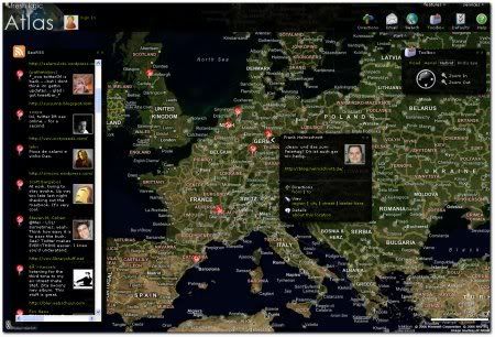
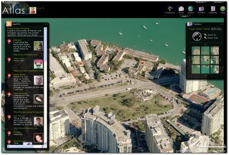
Twittervision dürfte bekannt sein, wesentlich schicker ist aber Twitter Atlas, ein neues Mashup aus Twitter und Virtual Earth von Microsoft (Pendant zu Google Maps/Earth), weil der berühmte Birds Eye View (nur bestimmte Locations leider) möglich ist:
via Mashable
hallo Frank, ich seh Dich:))